Fort Pierre to Deadwood Historic Trail
Deadwood stagecoach. Courtesy Library of Congress.
My neighbor thought I was nuts when I offered to drive half way across the state of South Dakota to pick up a piece of equipment for him. After all, we had just made that four-hour drive a few days before when taking cattle to a sale. But I had discovered that about half the drive followed an historic stagecoach route, and I had a project there I wanted to do.
My neighbor has been making that drive for many years. It wasn’t until I was with him a few months ago, though, that he learned about the stage route connection. On that day, I noticed a white sign along the road that identified the stage route. And then I noticed another sign. And then another. My curiosity was piqued! I had already been studying a stage route near where we live: the Cheyenne to Deadwood Trail. This newly discovered (for us) trail was from Fort Pierre to Deadwood - Deadwood being a gold mining town beginning in the late 1800s. Fort Pierre, on the Missouri River, was the closest that boats could get to that gold mining district in the Black Hills. From Fort Pierre, stagecoaches took passengers and ox trains took cargo to Deadwood.
When we passed the first sign on that discovery trip, my neighbor asked how far it might be to the next sign. I guessed 8-12 miles since that’s the typical distance between stage stops, which was determined by the stamina of the horses pulling the stagecoach and the terrain over which they were traveling. But the distance this time was just 2 miles, which is unusual for markers of historic trails.
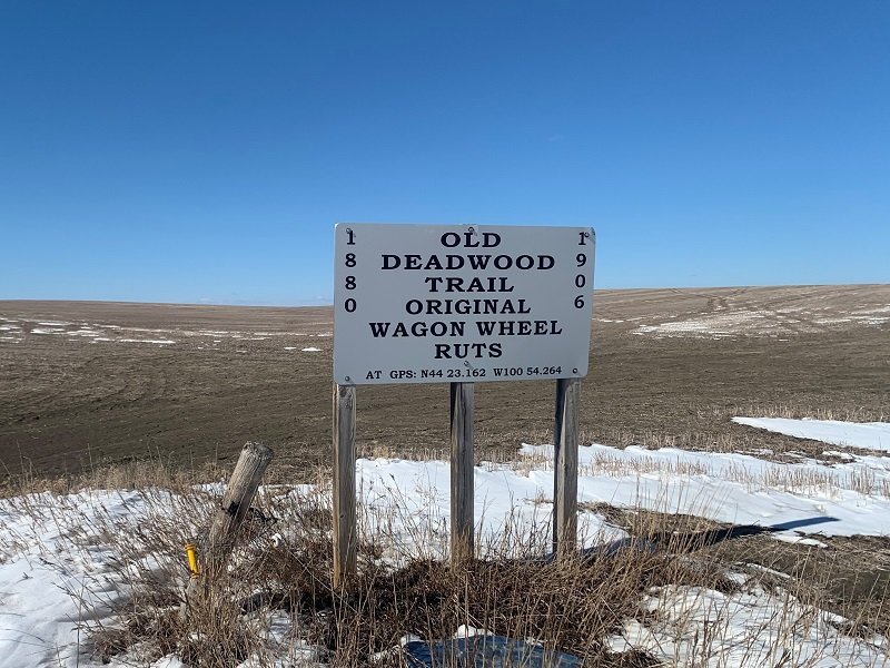
It turns out that the Fort Pierre to Deadwood trail was very fortunate to have some dedicated fans. In the 1970s, local ranchers Roy and Edith Norman took an interest in ensuring the trail’s history would be remembered. Roy had learned of the trail and its many significant features when riding horseback as a young man. So he and Edith created signs and placed them along the highway with the permission of the landowners. On the signs, they included GPS coordinates that they had surveyed, marking the exact location of the features described on the signs. Volunteers since then have maintained the signs. The signs all face east, for westbound traffic, reflecting the historic flow of people, animals, and goods.
On my equipment hauling day, my project was to photograph all the signs west of Fort Pierre along my route. As it turned out, I only managed to stop and photograph a third of the signs before I ran out of time; you can see them below. Since ranch errands often take us that way, I look forward to finishing the project in the future. A few of the signs that I did take pictures of indicate where the Black and Yellow Trail and the Deadwood Trail cross. The Black and Yellow Trail was a promotional trail inspired by the emerging popularity of the automobile in the early 20th century. The Black and Yellow Trail connected Chicago with the Black Hills and Yellowstone National Park .
I suspect I have my neighbor thinking differently about features along the route. On that first discovery trip, he asked about a town ahead, wondering if it was founded to support the railroad that paralleled the highway. I smiled and explained that, in my research of various historic trails, what are today highways often follow rail corridors, which often followed stagecoach trails, which sometimes followed Pony Express mail routes, both of which often followed native trails. So the town in question may well have pre-dated the railroad because it was a station on the stagecoach or Pony Express route.
Post offices are indicated by some signs, reflecting that an important early use of the trail was for mail delivery. In addition to the signs along the route marking the Deadwood and Black and Yellow Trails are other privately erected interpretive signs about Native American history. A rich route indeed!
© Jenifer Morrissey, 2022


